Every day in Spain, there are between 10 and 20 earthquakes on average, according to the country’s National Geographic Institute.
These figures pale by comparison with other nations such as Indonesia, Japan, Chile, Mexico or the United States, where daily tremors are routinely in the hundreds due to their location on or close to fault lines.
In truth, there are tens of thousands of earthquakes around the world every year as the earth’s tectonic plates are constantly shifting, but the vast majority of these tremors go unnoticed.
It is of course their magnitude, measured with the Richter scale, which helps scientists determine the strength of earthquakes.
Almost all of the terremotos (earthquakes in Spanish) recorded in Spain on a daily basis have a magnitude of between 1.7 and 4, which on the higher end can result in mild shaking.
For context, a major earthquake that results in serious damage is considered to be one of between 7.0 and 7.9 on the Richter scale, levels reached in Turkey and Syria’s February 2023 earthquakes.
So it’s no surprise that Spain is not classified by seismologists as a country that’s prone to serious and destructive quakes.
Earthquakes measuring 5.0, strong enough to cause some damage, are recorded on average in Spain every three and a half years.
However, seismic activity and plate movement is constantly evolving.
A few kilometres from the coasts of the Iberian Peninsula, the Eurasian and African plates converge, with the African continent actually gradually moving closer to Europe, although only at a speed of five millimetres a year.
Geologists still consider that this is increasing the risk of more severe earthquakes taking place in parts of Spain that are home to 14 million people, as they also happen to be densely populated areas.
For Huelva University Geology professor Francisco Manuel Alonso, fault lines along these Eurasian and African plates mean that an earthquake as severe as Turkey’s cannot be completely ruled out in Spain.
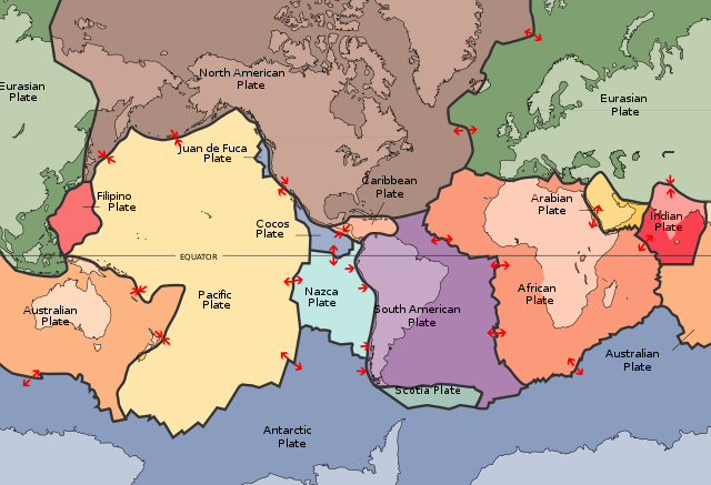 Simplified map of Earth's main tectonic plates, showing how the African and Eurasian plates converge along the Straight of Gibraltar. Map: Wikipedia/Public Domain
Fault lines along the very same plates - the Eurasian and African plates - but towards the eastern edge of the Mediterranean, are what’s caused the catastrophic Anatolian earthquake.
The following map by Spain’s Geographical Institute (IGN) shows that the parts of Spain with the most frequent seismic activity are in the south and east of the Iberian Peninsula, where the Eurasian and African plates converge.
There is also considerable seismic activity around the Pyrenees, given the fact that this is the edge of where one plate has slid beneath the other, a process seismologists refer to as subduction.
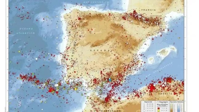 Map showing average seismic activity across the Iberian Peninsula. Source: Spain's National Geographic Institute
The Spanish provinces classified as “hotspots” for earthquakes are Granada, Almería, Málaga, Murcia and Alicante.
According to IGN’s seismologist Luis Cabañas, the potentially ensuing tsunami that could be caused by large earthquakes means that the southwestern provinces of Cádiz and Huelva are also at greater risk of damage.
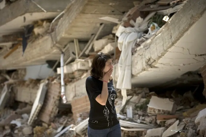
The Murcian town of Lorca is the place that records the most seismic activity in the country. In 2011, a 5.1 earthquake cost the lives of nine people and 80 percent of buildings located at the earthquake’s epicentre were damaged.
There are records of destructive quakes in Spain dating back to 300 AD, with geologists able to estimate to some extent their position on the Richter scale based on remains of the damage caused.
The most destructive ones are believed to have been in Seville in 1504, in Almería in 1522, in Málaga in 1680, in 1829 in Torrevieja and in 1884 in Granada.
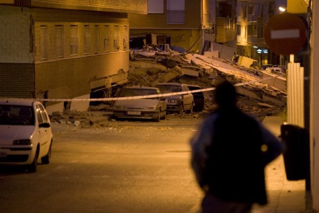 A man looks at cars crashed by debris from a collapsed building in Lorca, southern Spain, in 2011 after a magnitude 5.2 quake killed at least 10 people, toppling buildings into the streets and sending panicked residents fleeing. (Photo by Jorge Guerrero / AFP)
The worst Spanish quake in recent memory in the 20th and 21st century was that recorded in Lorca.
But it’s the Great Lisbon Earthquake of 1755, with a death toll of between 12,000 and 50,000 people and which was felt across the Iberian Peninsula, that not only went down in history but also highlights how the risk of a macroseism in Spain is - although unlikely - not impossible.
IGN recently reminded the public that “there is currently no method available capable of predicting the time, place and magnitude of an earthquake. The difficulty lies in the non-linear and rather chaotic behaviour of seismic movements”.
Comments