Published: 27 Feb, 2024 CET.Updated: Tue 27 Feb 2024 09:11 CET
Two people walk in the snow after a snowfall in the northern Spanish Navarre village of Orreaga - Roncesvalles on January 10, 2024. (Photo by ANDER GILLENEA / AFP)
Weather alerts have been issued across Spain for rain, strong winds, waves, and even snow in parts of the northern peninsula.
Advertisement
Spain is braced for its first significant snowfall of the winter with regions across the country on alert for strong winds and rain, with snowfall and wave surges forecast in some northern regions.
Heavy rain overnight in the Basque Country caused several rivers to overflow, mainly affecting the Vitoria area, and drivers were rescued from two vehicles in Navarre.
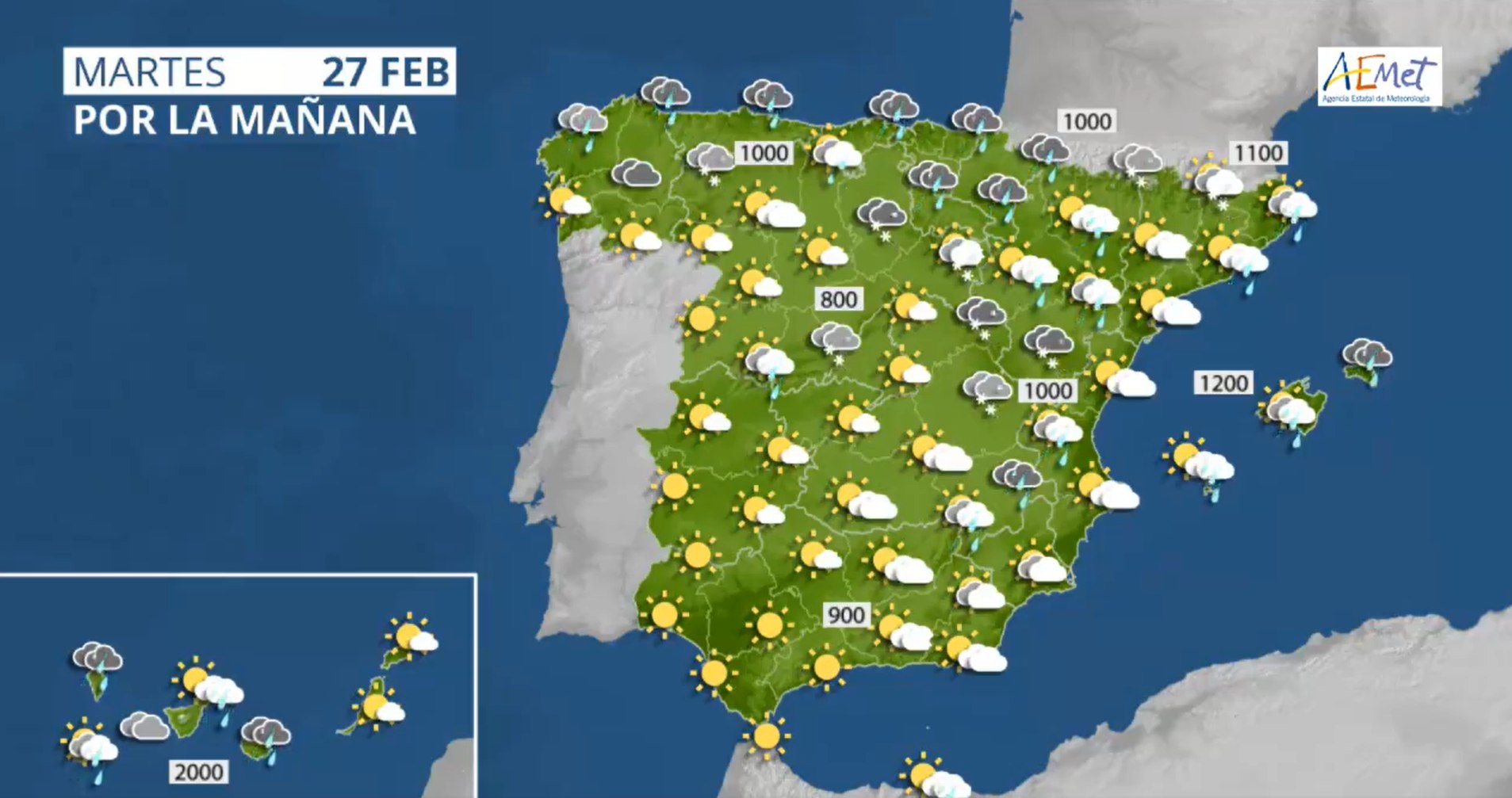
Weather forecast for Tuesday February 27th in Spain. Image: Aemet
As of Tuesday morning every region of Spain, except Extremadura, remains on either a yellow warning (at risk) or orange warning (significant risk), for rains, winds, snow, or strong waves, according to forecasts from the state Meteorological Agency (Aemet).
The regions on orange alert are: Aragón, Asturias, the Balearic Islands, the Canary Islands, Cantabria, Castile and Leon, Catalonia, Navarre, the Basque Country and the Valencian Community.
Andalusia, Castile-La Mancha, Galicia, Madrid, Murcia, La Rioja and the autonomous city of Melilla are on yellow alert.
Temperatures are set to fall almost everywhere in the country, except in the far west of the peninsula, and could even fall below zero in places such as Teruel, Ávila, Segovia and Palencia.
So far at least 72 motorways are affected by the weather, especially roads in Asturias, León, Cantabria, Palencia, Burgos and Lugo, according to this live traffic map by Spain's Dirección General de Tráfico (DGT).
Much of the snow is forecast to fall in mountainous areas, with a metre of snowfall predicted in the Cantabrian mountains, the Pyrenees and the Iberian system at elevations of 700-800 metres. In the Sierra Nevada and other southeastern mountain ranges light snow is forecast from 900 metres.
In Catalonia, an orange alert has been activated in Lleida for snow above 1,000 meters and there is a risk of avalanches.
Advertisement
In the Valencian Community, an orange level warning has been issued in Castellón for gusts between 90-100 km/h, and large parts of the peninsula could see winds of 70-80km/h.
In the Canary Islands, the orange alert particularly affects La Palma with maximum gusts of 90 km/h forecast. Strong winds are also expected in El Paso, though are forecast to affect the majority of the islands and cause strong waves.
Join the conversation in our comments section below. Share your own views and experience and if you have a question or suggestion for our journalists then email us at [email protected].
Please keep comments civil, constructive and on topic – and make sure to read our terms of use before getting involved.

 Weather forecast for Tuesday February 27th in Spain. Image: Aemet
Join the conversation in our comments section below. Share your own views and experience and if you have a question or suggestion for our journalists then email us at [email protected].
Please keep comments civil, constructive and on topic – and make sure to read our terms of use before getting involved.
Please log in here to leave a comment.