Rain and snow to sweep across Spain on first week of 2024
Spain has had an unusually warm winter so far with high temperatures of around 20C in Andalusia and the Mediterranean coast over Christmas week, but all that could be about to change in the start of the new year.
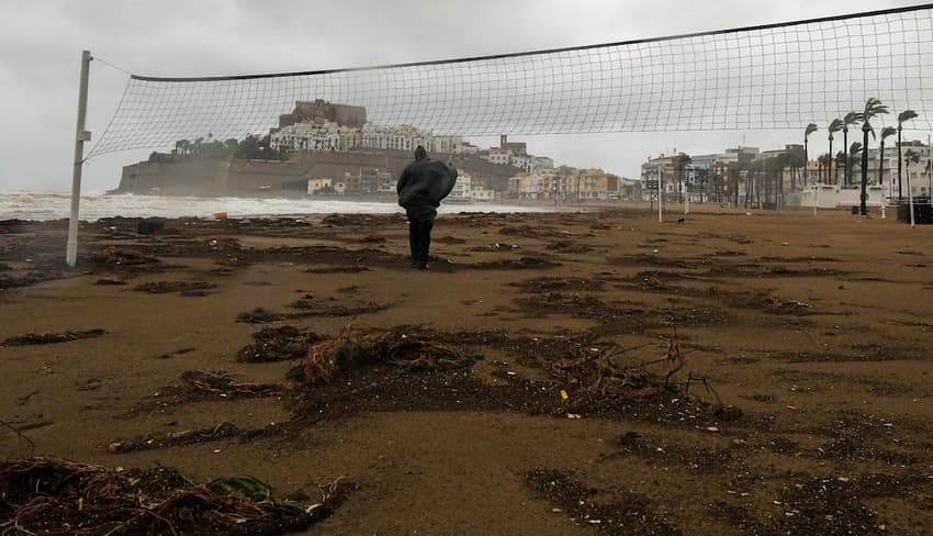
From Tuesday January 2nd, Spain will start to be affected by incoming polar or arctic air, which will bring freezing temperatures, snow and rain to parts of the country.
This is much needed in drought-hit areas of Catalonia and Andalusia which have seen very little rain all year.
Rain is expected during the first half of the week in the northwest quadrant of Spain, with snow starting at about 1,700 metres. The cold front will bring more intense and abundant rain in the north and west of Galicia, extending to the western Cantabrian Sea and into Castilla y León.
The conditions will also bring strong winds in the extreme north and the Cantabrian Mountains, with isolated frosts in the interior and mountainous areas of the country.
Temperatures will range from highs of 2C to 11C throughout much of the country, except the Andalusian and northern coastlines, the Balearics and the Canary Islands where they will be significantly higher - up to around 16C in some places.
READ ALSO: Where are the coldest places in Spain?
On Wednesday, January 3rd the cold front will continue to advance further south and cloud cover will be abundant. Rains are expected in western Andalusia, where they could be somewhat intense.
There will also be rainfall in Castilla-La Mancha, Madrid and Extremadura and some dispersed showers in Galicia and the west of the Canary Islands.
From Thursday, downpours are expected in the south and southeast of the country, as well as in the Balearic Islands. Another front will arrive via the Atlantic which will bring more rainfall to a large part of the north and west of the country too.
Temperatures will drop across the board and the snow level will settle between 1200-1600 metres with some isolated drizzle in the Canary Islands. Low temperatures will range from around -1C in the north up to a low of 12C in Cádiz and highs of 7C in the northwest to 21C in Málaga.
Metrological experts are predicting that the meeting of these two fronts could mean more polar air coming down through Europe and arriving in Spain by the end of the week.
Friday, the day when the Three Kings make their way across the country, could see further showers in Galicia, the Cantabrian coast, the Pyrenees, the Balearic Islands, Catalonia and in other inland areas, with a snow level that could drop below 1000 metres in the north.
By the weekend, the mercury will continue to fall and precipitation will be restricted to the Cantabrian slope, the Pyrenees, the Northern Iberian Peninsula, the Balearic Islands and the Central mountainous areas. In the Canary Islands, the possibility of showers will remain.
Comments
See Also
From Tuesday January 2nd, Spain will start to be affected by incoming polar or arctic air, which will bring freezing temperatures, snow and rain to parts of the country.
This is much needed in drought-hit areas of Catalonia and Andalusia which have seen very little rain all year.
Rain is expected during the first half of the week in the northwest quadrant of Spain, with snow starting at about 1,700 metres. The cold front will bring more intense and abundant rain in the north and west of Galicia, extending to the western Cantabrian Sea and into Castilla y León.
The conditions will also bring strong winds in the extreme north and the Cantabrian Mountains, with isolated frosts in the interior and mountainous areas of the country.
Temperatures will range from highs of 2C to 11C throughout much of the country, except the Andalusian and northern coastlines, the Balearics and the Canary Islands where they will be significantly higher - up to around 16C in some places.
READ ALSO: Where are the coldest places in Spain?
On Wednesday, January 3rd the cold front will continue to advance further south and cloud cover will be abundant. Rains are expected in western Andalusia, where they could be somewhat intense.
There will also be rainfall in Castilla-La Mancha, Madrid and Extremadura and some dispersed showers in Galicia and the west of the Canary Islands.
From Thursday, downpours are expected in the south and southeast of the country, as well as in the Balearic Islands. Another front will arrive via the Atlantic which will bring more rainfall to a large part of the north and west of the country too.
Temperatures will drop across the board and the snow level will settle between 1200-1600 metres with some isolated drizzle in the Canary Islands. Low temperatures will range from around -1C in the north up to a low of 12C in Cádiz and highs of 7C in the northwest to 21C in Málaga.
Metrological experts are predicting that the meeting of these two fronts could mean more polar air coming down through Europe and arriving in Spain by the end of the week.
Friday, the day when the Three Kings make their way across the country, could see further showers in Galicia, the Cantabrian coast, the Pyrenees, the Balearic Islands, Catalonia and in other inland areas, with a snow level that could drop below 1000 metres in the north.
By the weekend, the mercury will continue to fall and precipitation will be restricted to the Cantabrian slope, the Pyrenees, the Northern Iberian Peninsula, the Balearic Islands and the Central mountainous areas. In the Canary Islands, the possibility of showers will remain.
Join the conversation in our comments section below. Share your own views and experience and if you have a question or suggestion for our journalists then email us at [email protected].
Please keep comments civil, constructive and on topic – and make sure to read our terms of use before getting involved.
Please log in here to leave a comment.