The huge blaze, which broke out late Tuesday in a mountainous, northeastern area of the island, is the "most complex fire" to hit Spain's Canary Islands in more than 40 years, authorities said.
"The fire is beyond our capacity to extinguish it, maybe not in all sectors, but in a large part of the sectors," said Pedro Martinez, who is in charge of efforts to quench the blaze.
Martinez also added that operations to tackle the flames were being hampered by huge clouds of smoke and strong winds.
"Weather conditions last night were frankly severe [...] meaning the fire spread, mainly along the northern slopes," Canary Islands leader Fernando Clavijo told reporters, pointing to "much stronger winds, temperatures much higher than expected and lower relative humidity".
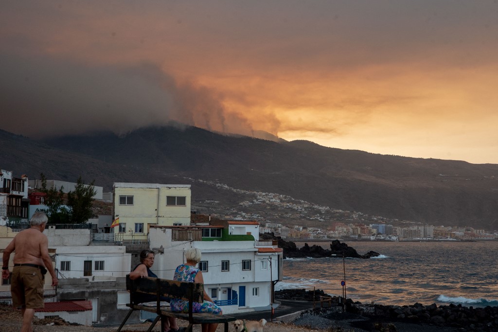
By Friday night, the fire had forced more than 4,500 people to flee although there was no update on how many people had been affected by the early morning evacuations in five municipalities.
"The fire and the weather have changed and we've had to evacuate five municipalities in northern Tenerife," said Manuel Miranda, the islands' head of emergencies, on X, formerly known as Twitter.
Miranda also pointed to "the danger and the proximity of the fire".
The latest evacuations came as forecasters warned that high temperatures and strong gusts of wind over the weekend would further complicate efforts to tackle the blaze.
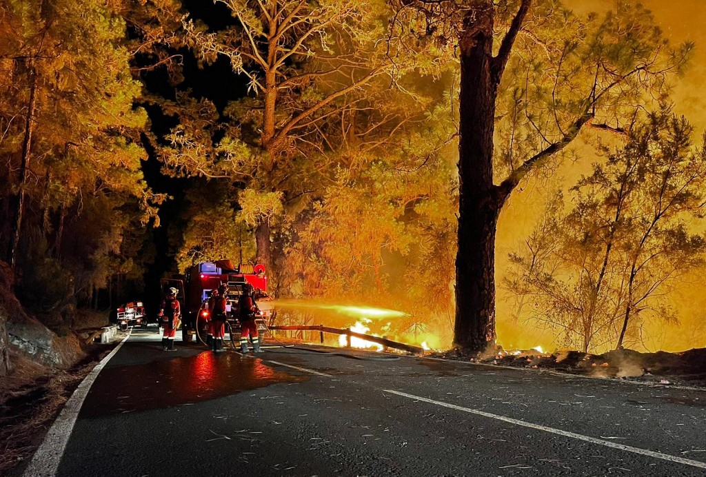
The fire, which has a perimeter of 50 kilometres (30 miles), has so far destroyed 5,000 hectares (over 12,300 acres) of land with 225 firefighters engaged in overnight efforts to control the flames.
The area affected by the fire equates to nearly 2.5 percent of Tenerife's surface area, which stretches for some 203,400 hectares.
Interior Minister Fernando Grande-Marlaska was due to visit the fire control centre on Saturday along with Tourism Minister Hector Gomez, while Prime Minister Pedro Sanchez was due to fly in on Monday, officials said.
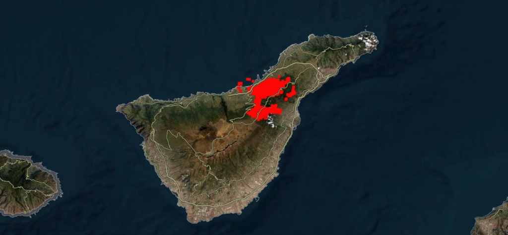
By Friday night, the blaze had affected 10 municipalities on Tenerife, the largest of the seven islands that make up Spain's Canary Islands.
On Friday, there had been a "favourable evolution" after a night in which the flames advanced more slowly and predictably and the winds eased.
That followed two days in which the behaviour of the fire was "highly unusual", complicating efforts to control it.
READ ALSO: IN IMAGES: How the worst wildfire in 40 years is engulfing Spain's Tenerife
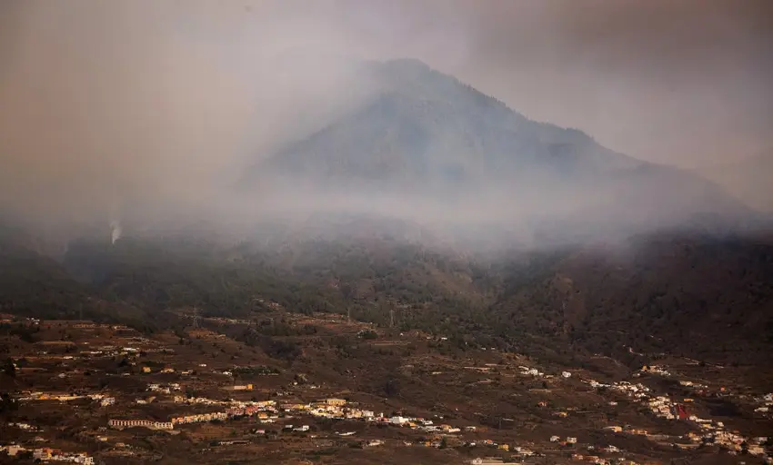
The blaze has generated a vast pillar of smoke that now stretches eight kilometres into the air, rising far above the summit of Mount Teide, the volcano that towers over the island.
At 3,715 metres (12,200 feet), Teide is Spain's highest peak and a popular tourist destination, but all roads to the national park were closed on Thursday.
The blaze broke out after the archipelago suffered a heatwave that left many areas tinder-dry.
As global temperatures rise due to climate change, scientists have warned heatwaves will become more frequent and intense.
READ ALSO: What to do and what to avoid if you witness a forest fire in Spain
Last year was a particularly bad year for wildfires in Europe, with Spain being the worst-hit nation as nearly 500 blazes destroyed more than 300,000 hectares of land, according to the European Forest Fire Information System (EFFIS).
So far this year, EFFIS says almost 76,000 hectares have been ravaged by some 340 fires in Spain, making it one of the European countries most vulnerable to climate change.
Comments